Government has two weather satellite programs, and both have major problemsWashington Business Journal
Jill R. AitoroSenior Staff Reporter- Jan 16, 2015, 2:47pm EST Updated: Jan 16, 2015, 3:27pm EST
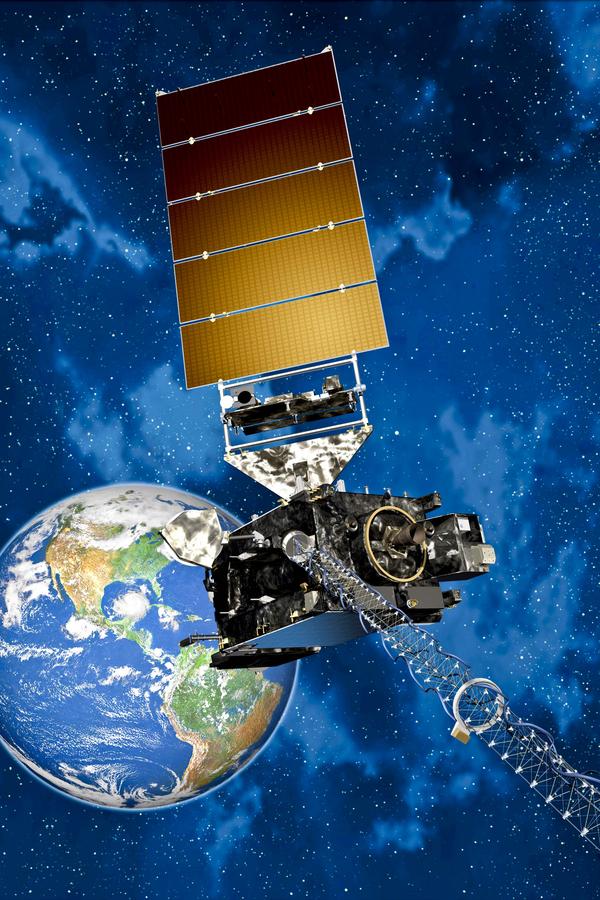 The GAO released two separate reports on multi-billion dollar satellite programs used to track weather, and in both cases, warned of potential gaps in data. Courtesy Lockheed Martin Corp.
The federal government touts two major satellite programs for weather forecasting. And both are facing delays that could translate into gaps in crucial data used to track extreme storms, including hurricanes.
The Government Accountability Office released two separate reports Thursday. One looked at the state of the Joint Polar Satellite System, or JPSS-1, which circles the Earth north to south twice a day in parallel with the sun, and the other examining the Geostationary Operational Environmental Satellite-R program, or GOES-R, which will orbit the Earth above the equator and record distant images of the Western Hemisphere.
Both National Oceanic and Atmospheric Administration programs, which deliver environmental data, face similar challenges.
JPSS-1, which is being built by Ball Aerospace, with separate contracts awarded to Raytheon Co., Exelis Inc. and Northrop Grumman Corp. for tool development, includes three satellites, the first of which was successfully launched in October 2011. In July 2013, the NOAA established a cost baseline of $11.3 billion for the program through fiscal year 2025, and the good news is, it remains within cost and schedule baselines. But the less promising news, according to the GAO, is that recent cost growth on key components is "likely unsustainable and risks remain that could increase the potential for near-term satellite data gaps."
One NOAA estimate puts a data gap at three months, but the GAO warns it could start earlier and last longer — from 11 months to more than 3 years.
Why might that be significant? The National Weather Service performed case studies to demonstrate how its forecasts would have been affected if there were no polar satellite data in the afternoon orbit, which is what JPSS-1 provides, and found it would have under-forecasted by at least 10 inches the amount of snow that fell during the "Snowmaggedon" winter storm in February 2010.
And a European weather organization recently reported that forecasts of Hurricane Sandy's track could have been hundreds of miles off without polar-orbiting satellites — rather than identifying the New Jersey landfall within 30 miles four days before landfall. Without the data, forecasts of the storm would've predicted it remaining out at sea
Complementing JPSS-1 is GOES-R, under development by Lockheed Martin Corp. (NYSE: LMT). The $1.09 billion contract for two satellites was awarded in 2008 to replace the current GOES system, with the total cost of the program expected to reach $10.86 billion by through 2036. And again, there is good news: Major progress has been made in developing the first satellite, the GAO noted in its report, including completing testing of satellite instruments.
But it continues to face challenges in the areas of schedule, cost, and functionality. Also, in order to meet the 2016 launch date, the program has deferred some planned functionality until after launch, and program officials acknowledge they may defer more, GAO reported.
"As the GOES-R program approaches its expected launch date of March 2016, it faces a potential gap of more than a year during which an on-orbit backup satellite would not be available," GAO reported. "This means that if an operational satellite experiences a problem, there could be a gap in GOES coverage."
For both programs, NOAA is addressing any defects in components that are contributing to delays, and coming up with contingency plans, should there be any gap in data. But it is unclear whether ground can be made up to eliminate potential gaps.
As I reported in March 2013, some of the challenges faced by NOAA and its contractors are the product of timing. Delays spurred by funding restraints changed deployment schedules, which added to the stress by causing two satellites to be developed simultaneously.
"Historically, NOAA was hoping to have one major program in full production at once, so while one was gearing up to major funding, the other would come down," Eric Webster, vice president and director of weather systems at Exelis told me at the time. "It didn't work out that way, and that caused some problems."
http://www.bizjournals.com/washington/blog/fedbiz_daily/2015/01/government-has-two-weather-satellite-programs-and.html?ana=yahoo&page=all


 Random quote

